

[ad_1]
Forecasters are predicting an exceptionally busy Atlantic cyclone season and fear that conditions are ripe to turbo-charge several devastating hurricanes.
Two of the most damaging hurricanes in history, the category four Hurricane Opal in 1995 and the category five Hurricane Katrina in 2005, were intensified by something called the Loop Current in the Gulf of Mexico.
This ocean current protrudes through the Yucatan Channel into the belly of the gulf before exiting through the Straits of Florida. This year it has pushed much farther north than usual.
“When the Loop Current is extended, it eventually sheds a large eddy, or Ring, which then drifts westward, whereas the Loop Current retracts to the south,” explained the US National Oceanic and Atmospheric Administration (NOAA).
An eddy from the Loop Current powered Hurricane Katrine up from a tropical cyclone as it passed through the Straits of Florida into a category five hurricane that ultimately flooded much of New Orleans and caused more than $100bn in damages.
For the seventh year in a row NOAA has forecast an above-average hurricane season, with between 14 and 21 named storms, with 70% confidence.
Meteorologists fear if one of these tropical storms was to pass over the deep warm waters of the Loop Current they could strengthen into extremely powerful hurricanes – and do so almost overnight.
NOAA expects between three to six major hurricanes – above category three with winds of 111 mph or higher.
Writing for The Conversation, Professor Nick Shay at the University of Miami said: “I have been monitoring ocean heat content for more than 30 years as a marine scientist. The conditions I see in the Gulf in May 2022 are cause for concern.”
He described the Loop Current as “the 800-pound gorilla of Gulf hurricane risks” and said: “When the Loop Current reaches this far north this early in the hurricane season – especially during what’s forecast to be a busy season – it can spell disaster for folks along the Northern Gulf Coast, from Texas to Florida.”

Loop Current visible on sea surface temperature observed by satellite. Pic: NOAA/AOML OceanViewer
Storms ‘exploding almost overnight’
Professor Shay said the Loop Current helped Hurricane Ida in August in 2021 “explode almost overnight” due to its surface temperature of over 30 C (86F) which extended down to about 180m (590ft).
This year, by mid-May, the Loop Current already has water temperatures of around 25 C (78 F) up to 100m (330ft) deep and Professor Shay said he expected this to grow.

Track of Hurricane Katrina overlaid on heat conditions in the Gulf of Mexico in 2005. Pic: NOAA
“Within a storm, warm ocean water can create towering plumes of rising warm, moist air, providing high-octane fuel for hurricanes,” he explained.
“As more moisture and heat rise within a hurricane, the pressure drops. The horizontal pressure difference from the centre of the storm to its periphery subsequently causes the wind to speed up and the hurricane to become increasingly dangerous.”
Because the Loop Current’s water is “deeper and warmer, and also saltier, than Gulf common water” it is able to retain heat at great depths, offering hurricanes a powerful injection of energy.
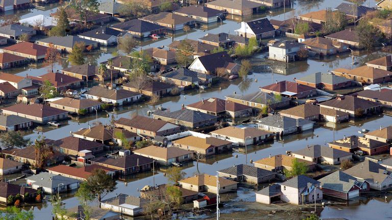
Much of New Orleans was flooded after Hurricane Katrina in 2005
‘Get ready now’
The most powerful and damaging hurricanes have historically occurred towards the end of the season, in August and September, as the summer continues to contribute to the seed weather effects.
“It’s important for everyone to understand their risk and take proactive steps to get ready now,” warned Deanne Criswell, the administrator of the US Federal Emergency Management Agency.
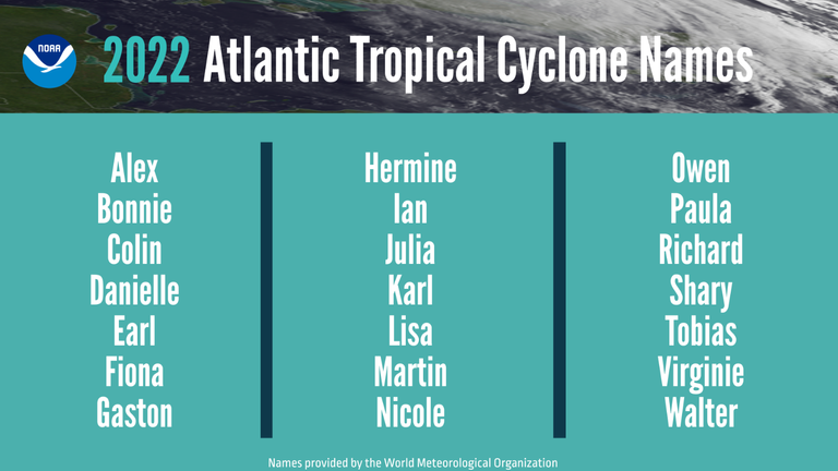
The World Meteorological Organisation has already chosen the list of names for this year’s storms
How do they make these predictions?
There are several climate factors contributing to this season, including La Nina, higher sea surface temperatures in the Atlantic and Caribbean, and a bumper west African monsoon season.
La Nina is expected to reduce wind sheer – changes in the speed and direction of the wind – which can help to suddenly defuse a storm by weakening and destabilising it.
The African weather results in much more powerful easterly waves which is how many of the strongest and longest-lived Atlantic hurricanes start to form.
“Early preparation and understanding your risk is key to being hurricane resilient and climate-ready,” said US Secretary of Commerce Gina Raimondo.
“Throughout the hurricane season, NOAA experts will work around the clock to provide early and accurate forecasts and warnings that communities in the path of storms can depend on to stay informed,” Ms Raimondo added.
[ad_2]